Saturday, July 24, 2010

DAY 74 FROM SOUTH TO NORTH - TOP END (NORTHERN TERRITORY) TRIP

7 July 2010

SAVANAH WAY – NATHAN RIVER HIGHWAY, LIMMEN NATIONAL PARK WESTERN LOST CITY


After a cool evening it was a surprisingly warm night last night.


It was an interesting day today. Very interesting scenery and we met interesting people. We met the owners of the Oka that is also here. Their set up is totally different to ours even though both are pop tops.


Passed wetlands we went


onto Marla Lagoon just before Limmen Bight Fishing Camp. This road was better than Nathan River Road. However, Marla Lagoon was a station not a lagoon accessible to the public. So we enjoyed the view of Limmen Bight River instead.


A new burn off was underway on the road when we back tracked on it.  It sure was not burning when we went up the road.  apparently they drop incineries from a helicopter to start the fire.


Then over the causeway at Cox River, cows,


and termite mounds

before we got to Nikantyrra Waterhole.


Limmen Bight River was just beautiful. We met an interesting couple from Araluen at the river.


This is wattle country at the moment. Wattles are in bloom everywhere.


We went to the Nathan River Ranger Station to get the key to get into Western Lost City. Just loved the fence from rail sleepers and tracks.


We nearly missed the track to the lost city. If it wasn't for the locked gate not far from the road we would have missed the track. We only noticed the track after we passed it so we had to turn around and come back to it.


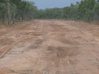
It is a 28km rough track to the lost city. It takes 2 hours to drive the 28km. My husband referred to it as ‘rough as guts’. It was rough in a different way to the tracks we had done at Gregory National Park recently. The track was of hard baked soil with lots of hard baked cow tracks.


There were several rocky creek crossings.


Limmen River Crossing was very sandy and reasonably steep on entry and exit and the base was pebbly. The river flows north east for 80km about where it enters the Gulf of Carpentaria. A bit further on, at another creek crossing there were some Stromatolites. I just loved the patterns on them.


We went passed a clear permanent waterhole and a Jabiru took off as we approached. There was a string of waterholes for a section of the track.


Two cows confronted us on the path before taking off into the scrub. We saw two water buffalo as well.


A section of black soil and hints of previous pastoral history were seen before the last stretch of road leading to the lost city.


Hubby was getting doubtful whether it was worth taking this little trip the further we went especially as towards the end of the track it was quite tight going.


We were collecting wattle flowers, twigs, leaves and branches on the front windscreen and inside the car as we had our windows open.


The lost city was just AWESOME.  Interesting rock formations growing in size the further you went in. As we weaved through the formations we felt as small as ants in comparison to these gigantic sandstone pillars.


Apparently they were formed 15000 million years ago as part of an ancient seabed that cracked and split as it was exposed. Then the wind and water have carved the incredible shapes.


The colours are interesting too and are a result of different mineral composition of the sandstone.


Another of nature’s wanders.


We took our time looking around and then headed back along the track we came in.


We frightened a bull that was drinking at a waterhole. He suddenly turned when he heard us and took off across the road then stopped and stared at us.


We returned the key and it was getting late by the time we got to Butterfly Springs for the night.

Wednesday, July 21, 2010

DAY 73 FROM SOUTH TO NORTH - TOP END (NORTHERN TERRITORY) TRIP

6 July 2010

SAVANAH WAY – NATHAN RIVER HIGHWAY

We didn’t get far today. We backtracked back to Nathan River Road and explored the tracks off the road.

Twenty one kilometres up the road was another campsite. In our track notes it said “Very popular site for caravan travellers and anglers during the dry season. Campers advised to be self-sufficient and have their own chemical toilet”. I thought that was a strange description to include. I had never seen any reference to having a chemical toilet before. Well when we got there I soon found out why. Tomato Island – as the place is called- was a real gypsy camp. Instead of gypsies they were fishing folk. The campsite was absolutely full and looked an absolute mess. Campers, tents, buses, caravans and barrels galore. Apparently they come here for three months and it is the same people every year. They get their diesel in barrels. I wander what happens to the empty ones. I hope someone takes them away. I would not like to stay here.


We dropped into several other campsites along the Roper River.


At one of the campsites we helped out a group by giving them a turd to fix a tyre and lent them the compressor to blow up their tyres. They had gone for a drive up to Towns River yesterday and had punctured two tyres.


We went past the St Vidgeon Homestead ruins on the way to Lomarieum Lagoon.


A beautiful spot.


From here to Towns River the road became bad. You could see the damage that had been caused during the wet and that was now under repair.

.


Washouts, extremely badly corrugations were par for the course here.


The track to Port Roper was closed. Some water was still on the road and it was drizzling all day on and off.


At least the scenery made up for the bad road.


We decided to stop for the day at Towns River and camped on the rocky ledge near the river. There are quite a few bush camp sites here. Another Oka was camped here. Quite a few camps were set up but not a person in sight as they were all out fishing in boats.


Hubby threw in a line but he had no luck. One fisherman when he came back offered us a quennie as he had just caught it today in the boat but had no room in the freezer. It made for a beautiful meal.


In the evening it felt very cool as it was windy even though it was 26 degrees.


This little fella was only a metre from the Oka and I think he was trying to tell us who was boss here.

DAY 72 FROM SOUTH TO NORTH - TOP END (NORTHERN TERRITORY) TRIP


5 July 2010

SAVANAH WAY – ROPER HIGHWAY, NATHAN RIVER HIGHWAY – ROPER BAR, ROCKY BAR CROSSING

(Lack of internet access meant delays in posting the blog.  I will try to catch up with posting them.)


We set off along the Savanah Way not knowing what to expect. It is described in many sources as sparse, undulating country with patches of scrub and rocky escarpments. We had also heard that the road to Roper Bar was boring. How wrong was that. It is an interesting road. The first section was a one lane sealed road.


When you saw oncoming traffic one had to move off to the side in order that the cars could pass. Most people did that. One driver towing a caravan was determined not to move onto the dirt part. Obviously he didn’t want to get the van dusty. He was put out as hubby moved over but not enough for him to be king of the road.


Elsie Creek, the first of many creek crossings, had quite a bit of water.


Each creek crossing is interesting. You look to see if they have water or not, what the vegetation is and what the base is like. They are all so different.


The road had a few crests for some part of it. When we got to the top we looked back – it looked spectacular.


Occasional rocky outcrops added interest to the scenery and provided a contrast to the many shades of green of the vegetation.


The scenery again was forever changing and so strong in contrast.


This was definitely pastoral country. Fences started to appear and we passed quite a few gates into properties.


We saw horses and for the first time some donkeys. There were quite a few cows grazing along the way.


There were several good camp spots are along the road between Stuart Highway and Roper Bar.


Mt McMinn ( we think that is what it is called) had interesting lines emerging from its formation and vegetation.


Even though the terrain appeared dryer here than other places there were still some wetlands with water along here. It was also drizzly at times during the day so not so nice a day weather wise.


Roper Bar store was quite a surprise. You can buy anything here. From paper clips, cup cake holders through to baby walkers. You name it, they had it. There is no other building or community here. An interesting place.


We called in at the ruins of the old police station. It was only in 1980 that they closed this station and moved it to a nearby community. It makes sense as there is nothing at Roper Bar.


Leichhardt’s Memorial is also at this site near the natural rock crossing, Leichhardt Crossing, over the Roper River.


The river is very wide at this point and it has a large volume of water flowing through it. I remember learning at school that there were not many rivers in Australia. There may not be many along the eastern part of Australia but there sure are quite a few large rivers up north. The only problem is that the creeks feeding the rivers dry up in the dry season and often during a prolonged or very hot dry season the rivers start to dry up and stop flowing.


As you crossed the river you got a glimpse of it from either side.


We went back along the road for a couple of kilometres before we came to a fork in the road. The track on the left was what we took to continue along the Savannah Way.


soon we were in Limmen National Park. We headed over the Hodgson River


and took a track to the right (south) to go to Rocky Bar crossing for the night.


The track was very sandy in places and also quite windy.


A series of rock pools upstream of the Hodgson River with little water cascades


with the river in full flow below.


A natural crossing along the river has been used to ford the river for many years. Now the track on the other side no longer exists.


Some of the rocks across the crossing seem to be split with water flowing between the split layers.


On the southern bank of the river there are many aboriginal petroglyphs – engravings on the rocks. They are rather weathered.


A beautiful setting for spending the night.


It may be a beautiful setting but it was also bug heaven. Insects of all descriptions and we made good fodder for them. We both got bitten heaps but not sure by what. They were not mosquitos. My fly glue paper strip was totally covered by insects within an hour of it being hung up. A hot night and insects is not a good combination for a good nights sleep.