Saturday, May 29, 2010

DAY 30 FROM SOUTH TO NORTH - TOP END (NORTHERN TERRITORY) TRIP

24 May 2010

TRAVELLING DAY - STUART HIGHWAY - KUNJARRA (THE PEBBLES),  TENNANT CREEK,  THREE WAYS,  NEWCASTLE WATERS


The day started badly. The fourth and fifth gears played up yesterday. So under the car hubby went . There was a lot of mud that needed clearing. In the process he found he was missing some tools.  It seems that someone left a roll of tools behind, those he liked to have handy, when he refilled the gas tank. Apparently many needed replacing so he was not unduly upset. However, we back tracked to Tennant Creek just in case someone handed them in at the caravan park that we had filled the gas tank up at. No luck. So to auto pro we went to get replacement tools. There was one he couldn’t replace so he will try to get it along the way.


It will take us several days to get to Timber Creek. There is not much along the way here. The road is very straight. We are travelling mainly through flat open land with the occasional rise or fall.


The scenery does change from time to time.


Lots of flowering wattle lined the road.


Every so often there was field upon field of termite mounds.


A lot of the information sheets mention that burning off is getting to be rarer in the Territory.   However, there was an area that was burnt out.


Mt Castle was impressive as there was nothing else simliar around. It was not very tall but rising out of the flat surrounding area it commanded a certain of presence.


Some of the creeks had water and north of Renner Springs there was again some water on the road.


We went past a very rock section of terrain and then back again to flat green area with small trees and scrub.


We stopped at a most imposing roadhouse at Three Ways.  Big and little boys would drool at this mural with an actual bull bar attached.  My grandsons would love it!


And for those with time to spare tables with the chess board all built in.


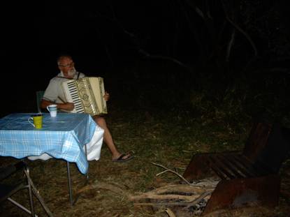
We pulled up for the night at Newcastle Waters rest stop. Caravan city it was. There were a few campers and one tent. Some had arrived at 1.30 pm to get there spot. By 5.00pm it was full. Some arrived later and chose to move on whilst others tried to sqeeze into any little bit of space available.


The storms clouds to the south of us looked ominous as they kept building. As we ate dinner we could see lightning in the distance but did not hear any thunder.

DAY 29 FROM SOUTH TO NORTH - TOP END (NORTHERN TERRITORY) TRIP

23 May 2010

DAVENPORT RANGES NATIONAL PARK – BINNS TRACK, STUART HIGHWAY - TENNANT CREEK – KUNJARRA (THE PEBBLES)


We decided to have an early start to leave before the tag-a-long group hit the road. It was another very overcast day. As we drove back along the Binns Track back to the highway we could see rain to the north and the south.


The trip back along the track seemed to take less time than getting there. The cows had made a mess of the track in many places.


I didn’t mention last time that along the track there were a few burnt out or abandoned cars. They appear to have been here a long time. What was upsetting were all the beer can strewn along the track and empty cartons and flagons. They were not there when we went up to the ranges on Friday. Obviously it was something that happened over the weekend.


When we hit the highway there was evidence of rain on the road.

We also heard a weather report forecasting severe storms over the Oodnadatta and Dalhousie Springs area and rain from Darwin to Alice Springs. It was also very hot and humid as it reached 33C and humidity must have been in high 80-90s.


Tenant Creek does not even sit near a creek so it is an unusual name for a town without a creek. They do have a beautiful dam – Lake Mary Anne – just north of the town that has been set up as a beautiful swimming and picnic area. A pity you cannot camp here.


At Tennant Creek we refuelled and got the gas tank filled up.


We then went to Battery Hill Mining Centre that was also the information centre. We chose not to go into the mine as we have been into several old mines in different places on previous trips. The information Billboards were well presented. Gold was discovered here in 1925 and drew the gold seekers in from everywhere.


At the information centre we found out that all 4WD tracks through Gregory National Park were closed. What a blow! That was to be one of our major detination points. There are very few tracks in the park and they are all 4WD except for one small section. We had really been looking forward to it. It is considered to be a very remote destination. There has been a lot of rain in Kunnurra area including Gregory in the last week. So we decided to alter our plans a bit by going to the north section of the park rather than the south end in the hope that it will be open by the time we get there.


We moved onto the The Pebbles – Kunjarra. It is like a miniature Devil’s Marbles. Lots of rocks but of a much smaller size. It is a special women’s site and the men could only come here when invited for corroborrees.


The weather looked suspicious. We had both internet and phone access here. So we contacted the kids and several friends. The radar showed that the weather would probably miss us.


Cleaning up after dinner I missed the window cleaner bottle and asked hubby if he had seen it. Apparently he had left it on the bull bar this morning after cleaning the window. Mmmmmmm! Well it is no longer with us.


At night we got a little bit of rain, thunder and wind but nothing major.

Sunday, May 23, 2010

DAYS 27-28 FROM SOUTH TO NORTH - TOP END (NORTHERN TERRITORY) TRIP

21-22 May 2010


DEVIL’S MARBLES – BINN'S TRACK - OLD POLICE STATION WATERHOLE, DAVENPORT RANGES NATIONAL PARK


Camped by the billabong near the old gum trees – what a wanderful place to be.


The birds are chirping from all directions, but not a single one is in sight as I write this blog covering the last two days.


Yesterday started as another overcast day. It was a warm night last night and just a slight drizzle of rain. The day was cool reaching only 17C by mid morning. When we got back onto Stuart Highway it was surprising to see the grass verge being cut alongside the road.


Before long we were back on the Binns tracks heading via Kurundi to Davenport Ranges.


Scenery was different again – more colourful - yellow and red flowering bushes.


The ant hills were getting to be bigger and more numerous.


There was lots of water on the track


or alongside the track.


The bottom of the Oka was getting very muddy.


The waterholes were full.  Still no sign of camels but we saw wild donkeys in several places along the track.


As we drove along a friend called up on the HF radio via a cell call. It was great to hear from him. He’d tried to get through to us before but we have had a bad signal. Last night we tried to call the kids but we just couldn’t make a connection. Anyway, he said „ I suppose you pulled over to the side of the road“. Hubby answered „No, I pulled up in the middle of the road“. As there was no traffic on the dirt track he had pulled over in the middle of the track as there was water on either side.


Kurundi appeared to be a staging post for road trains as there were several set up ready to go and lots of trailers waiting to be hinched up. Our grandsons would just love these big trucks.


We were jolted out of complacency seeing a road train coming towards us when we were past Kurundi.


We were further surprised when we came to the intersection at Epenarra - the homestead gardens were just beautiful. One can get fuel and supplies here. The connecting track to Barkly Homestead was still closed. We continued on the the Old Police Station Waterhole. It is a huge waterhole and except in severe drought a permanent water hole.


Red river gums line the bank.


There is an abundance of bird life judging tby the bird calls we can hear but we haven’t seen that many of them. But this is spider kingdom! You have to be very careful where you walk as the likelihood of walking into a web is very high and there can be a number of large spiders in a single web.


Davenport Ranges were mined for wolfram, gold, zinc and scheelite along the tributeries of the Frew River. Mining continued in the area till the mid 50s. There are ruins across the other side of the waterhole but there is too much water to get across the waterhole to the ruins. The ranges themselves are very weathered and low as they rise out of flat surrounding tableland. The tag along leader told us that where we were camped the waterhole was such that you could walk across it at this point. Not today – it extends quite far.


When we arrived we were the only ones here. So hubby checked that all was right with the vehicle.


As there was plenty of water we did our washing and relaxed.


Before long more vehicles arrived. We started to count them – eleven in all. It was a tag-a-long 4WD camping tour.


We decided to stay an extra day here and enjoy the setting.


We tried to listed to skeds on the HF radio but all we got was chatter from Indonesia and Malaysia. We tried to get through to the kids but again we couldn’t make a connection. So after a barbeque cooked over an open fire


it was time for some music and then bed.


On Saturday was hubby’s birthday so we had a special breakfast of Tia Maria banana pancakes.


I also made him Nigella’s Chocolate heart cake (but not in a heart shape). Thank you Vaiva for introducing me to this recipe. Then a roast pork dinner to finish off the day.


We spent the day talking, walking, and hubby reading his new book by Colin Rivers „ Campervan and Motorhome Book“.


Pam and Jim from the tag-a-long group that we got to know in the morning joined us for afternoon tea and some cake.


A lovely relaxing day.


We also seem to have escaped most of the rain that has come down the territory.


In the evening we joined the Outback tag –a-long tour at their camp fire for a most enjoyable evening.